The researchers and engineers developing the first digital mapping technologies for self-driving cars are well aware of the scale of their task – just think of the huge amount of information humans take in and process while they are driving.
At any moment, a human driver might be performing tens or hundreds of time-distance calculations to work out where their car will be in 10 seconds if they leave everything as it is, or tweak the steering wheel by a couple of degrees, or press on the accelerator, or any combination of actions, in order to avoid or pass other vehicles.
At the same time, they are navigating – in the more usual sense of working out which route to take to reach their intended destination, but also keeping between the white lines on the highway, steering around obstacles and choosing a speed that is appropriate for the road and the journey as well as within the legal limits.
All of that adds up to thousands of calculations a second, which humans do without even noticing. Replicating that speedy processing is critical to the success of self-driving or autonomous vehicles. And while the time-distance calculations and weighing one possible outcome against another – (is it better to accelerate slightly or turn the steering wheel a bit more? Should I slow down or speed up to avoid another vehicle changing lane?) – are relatively simple for artificial intelligence to calculate and even decide on, the processing takes up computer capacity. Add in the part about keeping to the road, and also the rules of the road, and computers can become overwhelmed.
A digital world
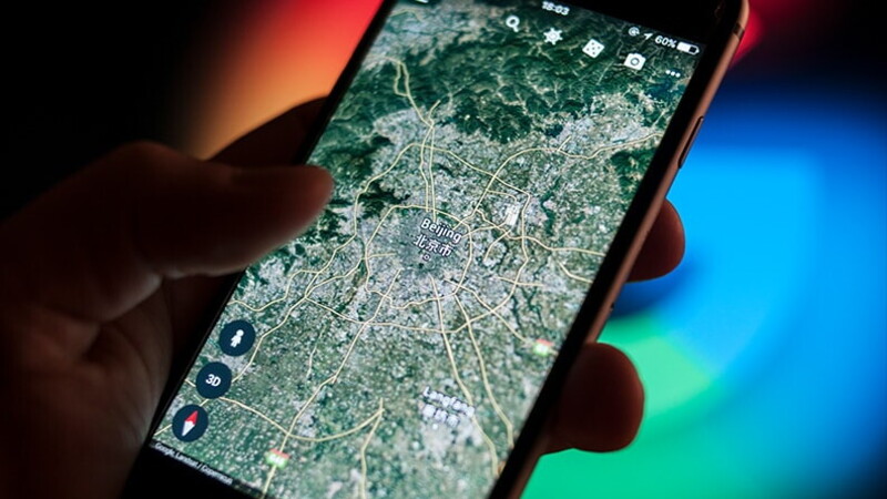
Just as the wise human looks at a map before setting off to a new destination, the answer lies in preparation. For self-driving vehicles, the equivalent is a pre-loaded, intricately detailed three-dimensional image of the world in which they are operating.
The more information self-driving cars have before they set off, the less computing power they need to recognise the static elements of their environment. Or, to put it another way, without such 3D maps the danger is that vehicles will not have the capacity to deal with the erratic movements of other cars, or to avoid children who run out into the street. Which means that the finely detailed maps are essential to making self-driving vehicles safe to use on the open road.
So what needs to be mapped? Where the road is, how narrow it is, how steep a gradient it has, whether it has stop signs or give-way markings or traffic lights, how slippery a surface it has in the wet and in the dry (and in between), where the traffic islands are, its speed limit… the list is not quite endless, but it is certainly long. Absolute precision is required on location, for example, to make up for the shortcomings of the global positioning system (GPS) and its regional rivals, whose signal can be downgraded in quality or turned off at political or military whim. Constant updating is vital.
Gathering data
A growing army of companies is busy collating data gathered from satellite images, laser scans of the physical world, photographs taken by Google Street View and a host of other sources that vary from government surveys to snaps taken by holidaymakers. “Map” is too small a word for the facsimiles they create – they are so real, detailed and complex that they could be used for any robot, drone or car, and have applications not just in transport and logistics but also in gaming, disaster relief and even planning military operations.
Yamaha, the Japanese motorcycle manufacturer, has devised an astonishing bike-riding autonomous android that exemplifies the problems of trying to consistently replicate the real world. Part of the MotoBot's value is being able to repeat riding inputs much more consistently than a human can. But, points out project leader Hiro Saijou, chief executive of Silicon Valley-based Yamaha Motor Ventures, it still can't achieve completely consistent lap times at a race circuit. “It might just be that the surface is slightly more slippery,” Saijou says. Or a shadow may have changed the temperature of the track for a crucial few minutes.
The prize is huge for those who can generate the required super-high-quality digital replicas of the world. It is not just driverless cars that need to know where they are – the potential for drones to deliver parcels, urgent medicines, military supplies and fare-paying passengers has hardly been explored. Self-flying vehicles also need to understand where they are, and they need to know whether a tall tower has been put up that will obstruct a path between buildings, or a tree has grown a few metres taller, making a flight along a canyon impossible.
Real-time tools
Hexagon Geospatial, based in the US, is at the forefront of those working with geographic information systems (GISs) to organise the welter of relevant information – location, changes, speed of change and much more – to provide three-dimensional maps, analyse the data and predict changes. In one topical example, it has provided GIS data to India's Maharashtra state to enable better prediction and control of forest fires, incorporating sensor-derived data to provide real-time tools.
Hexagon says its web-based or desktop application gives “users the ability to develop and utilise intricately detailed 3D reality meshes”. Scanning by laser and high-resolution images is accurate to less than a centimetre, and “digital realities can then be combined with dynamic data feeds that track and sense everything from air and noise pollution created by traffic to people-flow through cities”.
Other uses are real-time tracking of aircraft, with flights and topographical features shown in three dimensions, and managing traffic in busy airspace. German airline Lufthansa uses Hexagon systems to route flights around bad and hazardous weather.
Into the future
Companies whose work is more focused on ground-based vehicles include TomTom, which sells satellite navigation hardware to consumers; the formerly Nokia-owned Here, which is now controlled by German car companies, among others; Google parent Alphabet, which has in its stable Google Earth, Google Maps and Street View; and younger companies DeepMap and Civil Maps.
Creating an exact and intricately detailed digital replica of the real world is a fast-growing and hard-fought battleground – but it's also interim technology. Not far down the self-driving path, cars will have the sensors, computing power and artificial intelligence to read street signs, detect road conditions, predict hazards and react to them adroitly on the move, with a precisely metred and appropriate response all by themselves. Just like humans do now.